


First off, for those that don't know where Ainsworth State Park is, its a little park for nestled up on a hill just above Highway 36 and the Union Pacific Railroad tracks. It is on the eastern most end of the Highway and because of such, is fairly popular amongst travelers with RVs as someplace to stop for the night.
The campground is densely wooded, and has an abudance of pull thru and non pull thru sites. All sites, except for the small handful of primitive walk in Tent sites nestled way back on the southern most hills near the trail head of the Multnomah trails, are equipped with full hookups. There is also a dumpstation at the campground, and all the sites have a notice posted on their electrical boxes to NOT dump your full holding tank in your site as it will cause a sewage backup.
Since my lady does not have quite the same flexibility as I do with requesting time off, we were only able to go for her two days off for the week, and as such, left town right after she got off work tuesday night (Her days off were wednesday and thursday.)
When we pulled in to Ainsworth State Park (Exit #35 on I-84), most of the pull thru sites were full all along the backside of the campground. However, the back-in sites were almost all empty, with the exception of one smaller class C. I was, of course, the sole pickup camper in the area surrounded by giant Class As and Fifth wheels that I was amazed even made it in.
Ainsworth is an old state park, most of the facilities there haven't changed much since it originally opened. It is, however, only $16 a night for full hookups during Prime season as well. Normally, most state park sites with full hookups can run up around $22-26 a night, depending on where they're at.
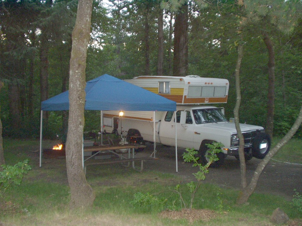
Our little campsite, its fairly nice, well shaded and with plenty of space to relax. The only draw backs I found out after we had settled in were, the UP tracks behind us are the main arterial route for all Freight going east and west, so somewhat frequent trains. That, and what I thought was bushes behind our site was actually a drop off with blackberry vines, old decidous trees and a view of Highway 36. At night, the highways empty, and even during the day, its not that busy, I didn't even know it was there and this site was better than the others (More shade, plus it didn't have a vent stack for the sewer system in it.)
Had I the choice, I might have tried for one of the pull thru sites on the back loop, since they were farther away, it might have been a tad quieter, but overall it wasn't that bad, we slept soundly without interruption and were not rushed or bothered by anyone. Nothing got stolen from camp while we were out hiking, so overall, no real major complaints about the site (Its site B-11 btw).
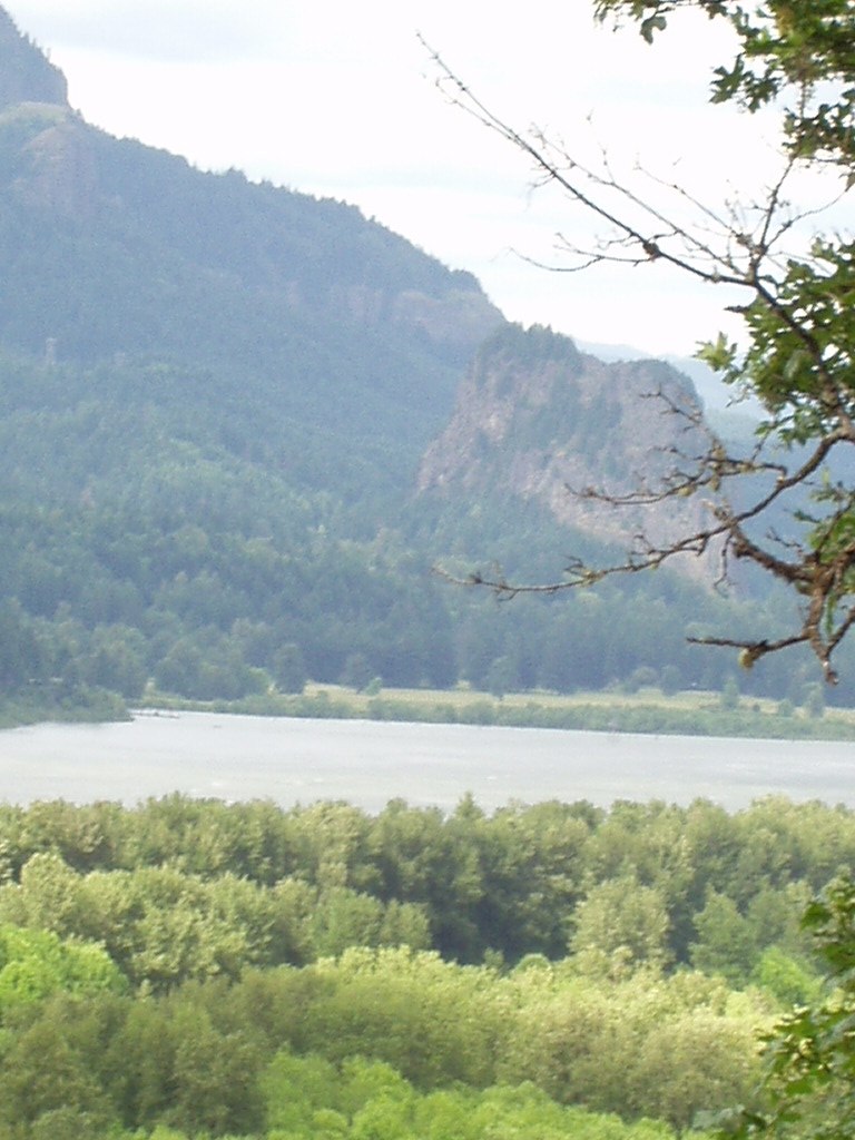
Plus, I got to wake up and see this out my front cabover window:
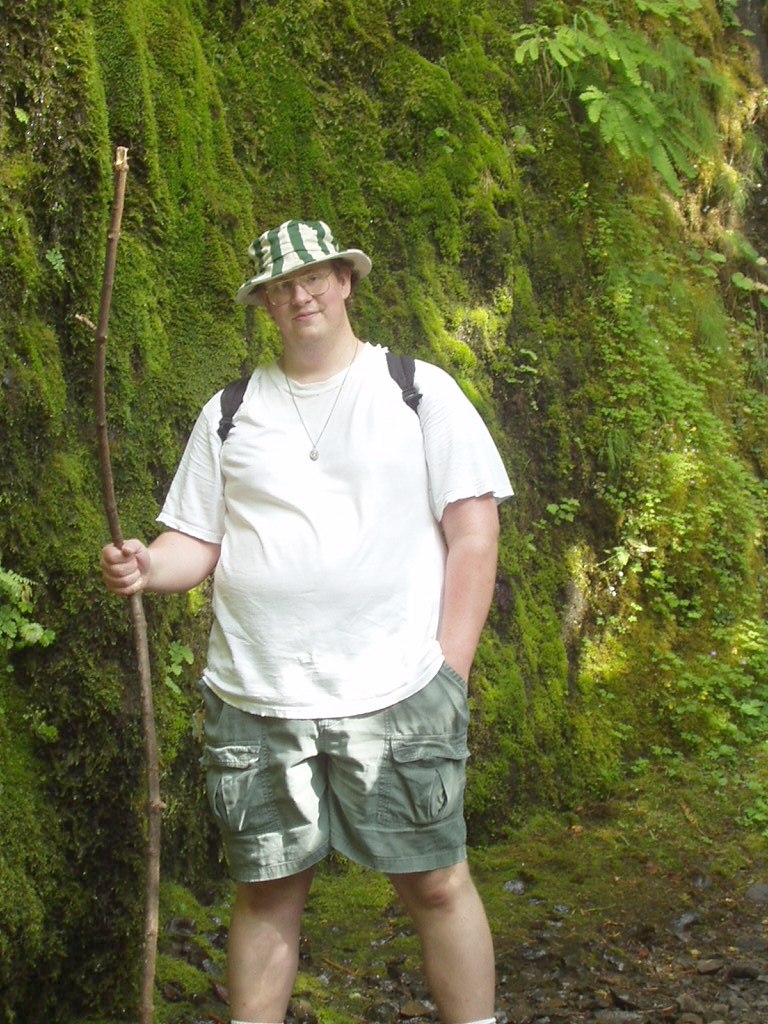
Since our primary objective of staying at Ainsworth was so that we could explore the additional Water Falls BEHIND the well traveled ones next to the highway, we went and hiked!
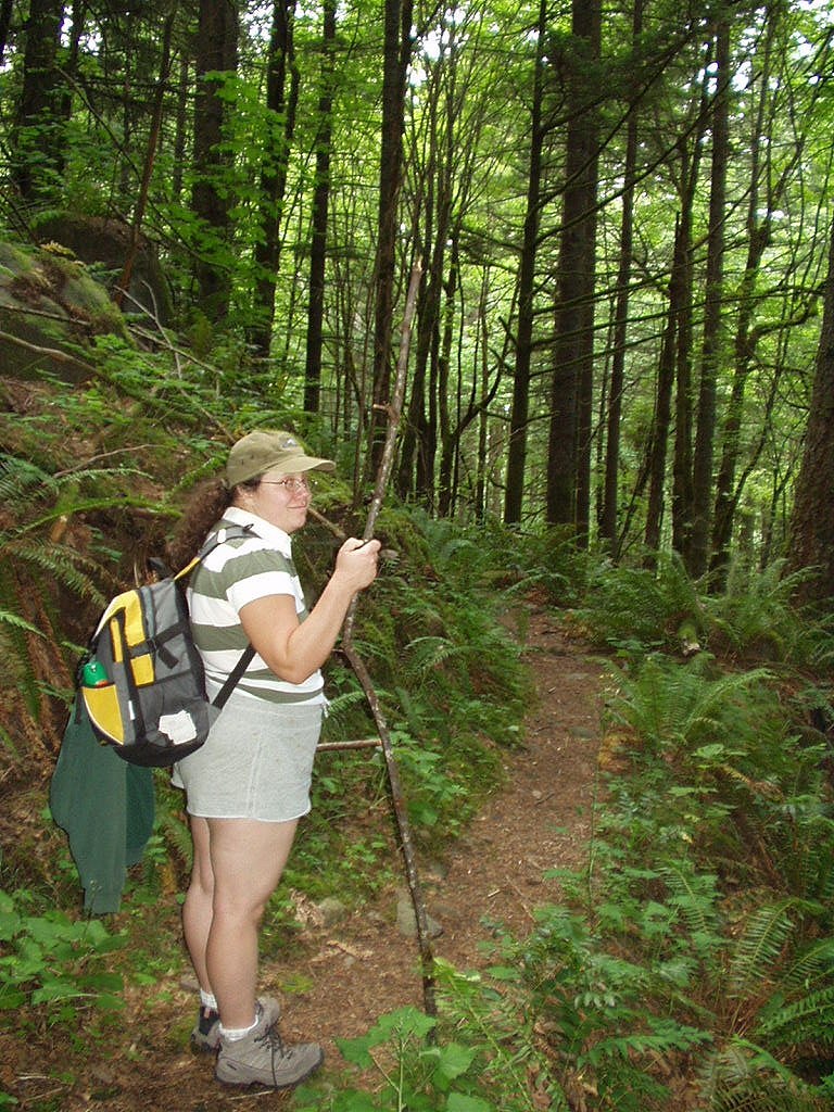
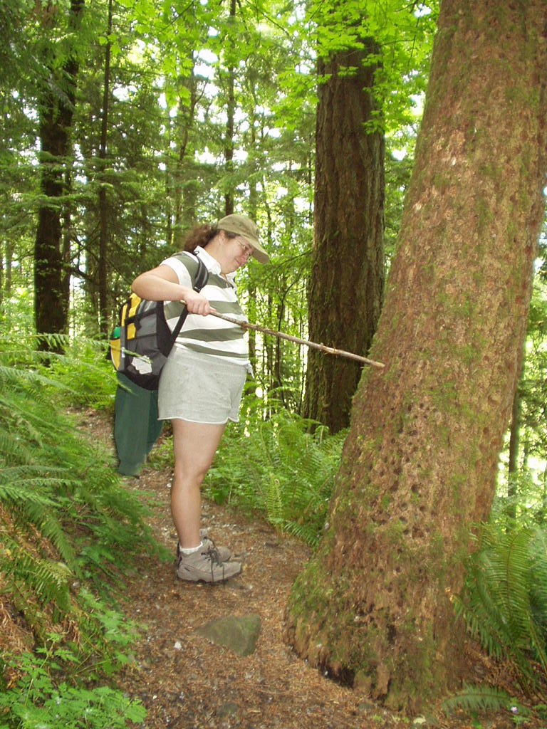
That last picture on the right is of my lady poking the trunk of a tree we found that was riddled from top to bottom with woodpecker holes, there wasn't a square inch of the trunk without them!
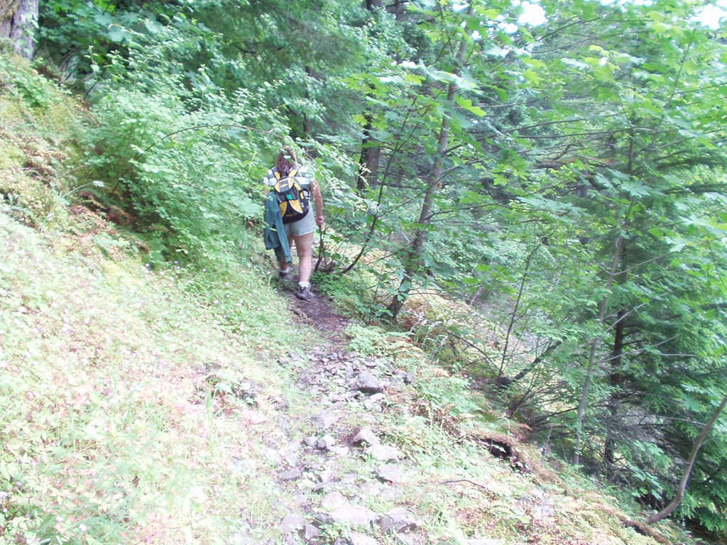
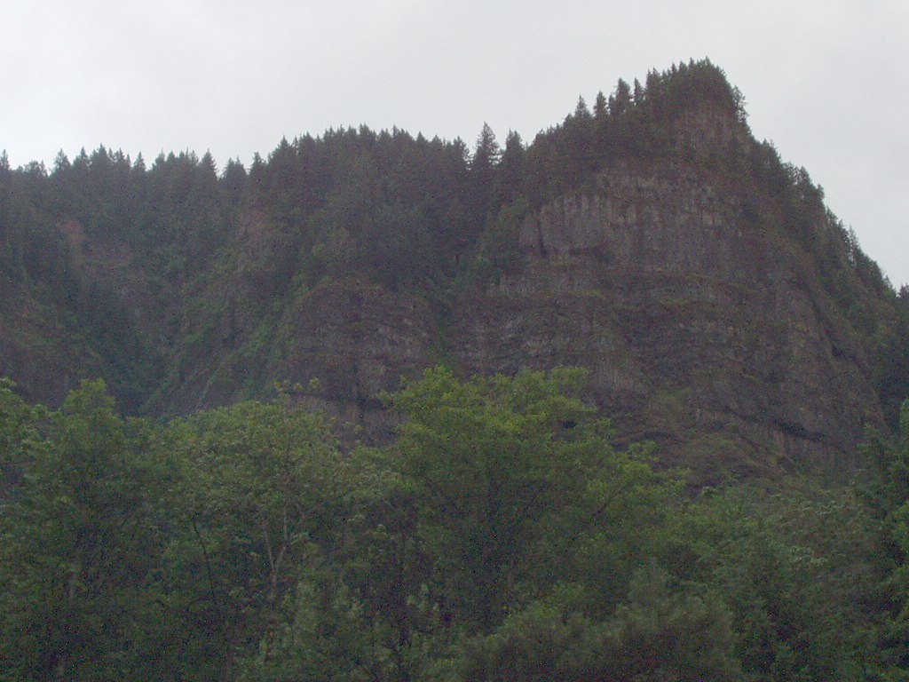
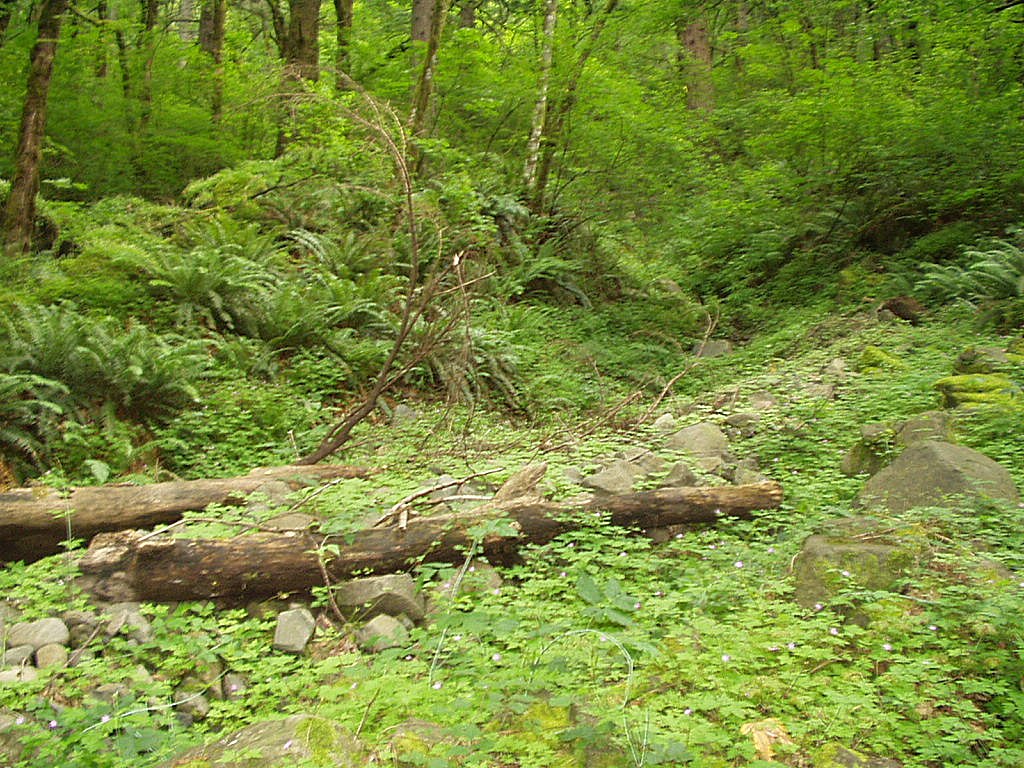
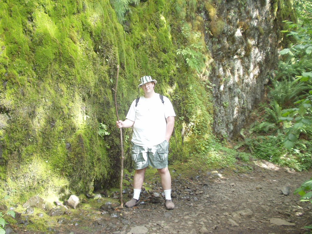
In case you're wondering, the trail we started on that eventually goes all the way to Multnomah Falls, starts out as Ainsworth Loop. Its of my opinion, some of the more moderately difficult trail in the area, the picture that is top left in the last batch of photos shows the conditions of some of the trail, which was loose large chunk rock with a steep drop on one side.
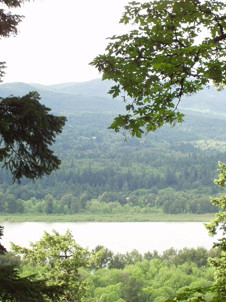
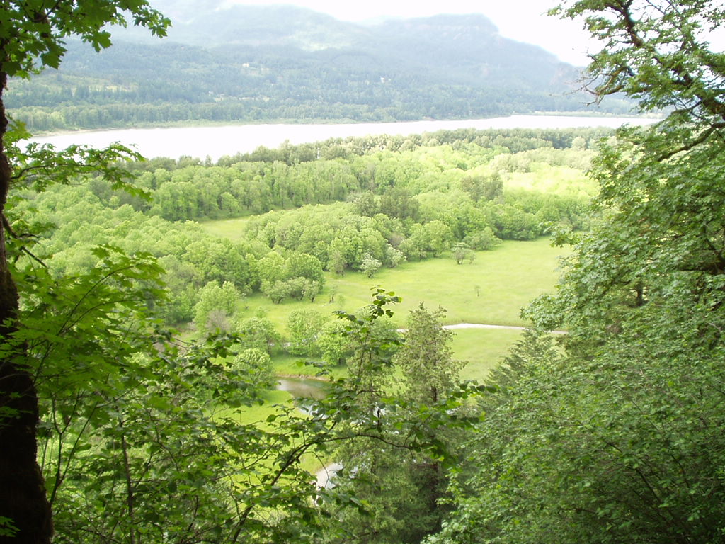
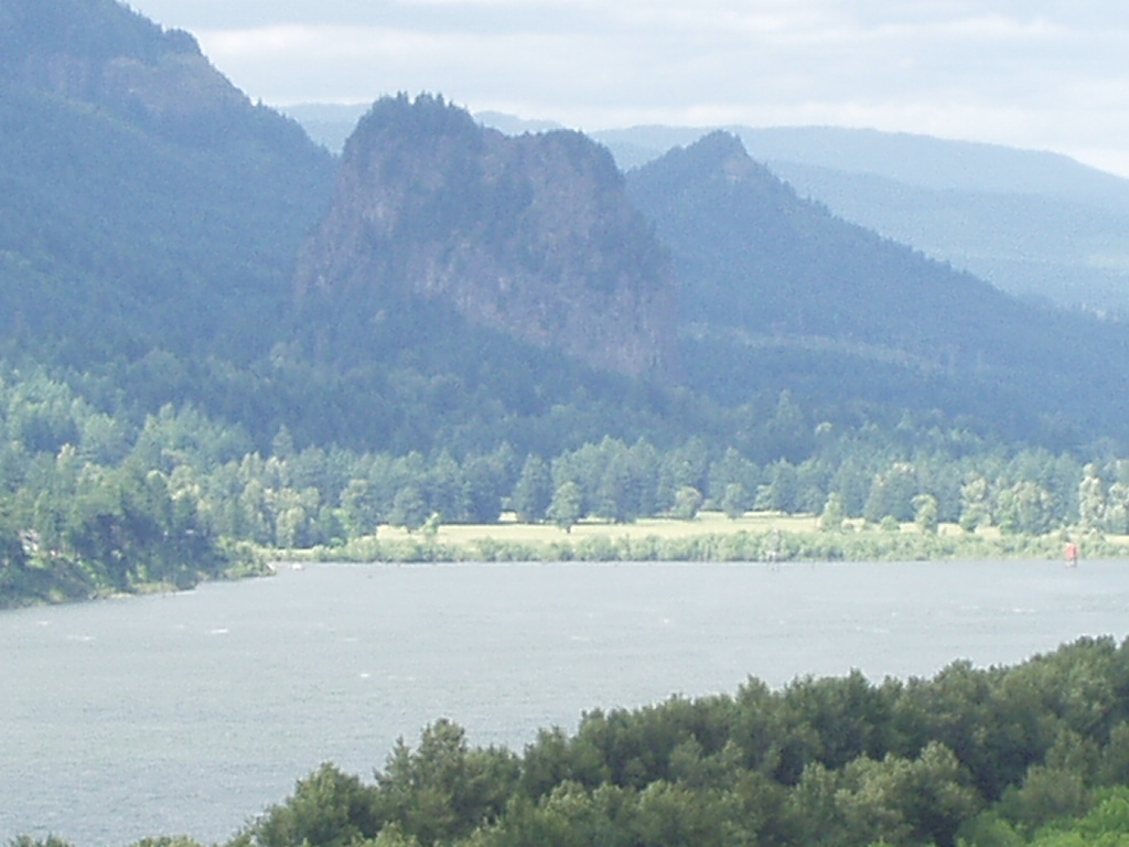
The other photos in that above batch are views afforded from the trail as it makes its way along the mountainside well above the highway, railroad, and interstate.
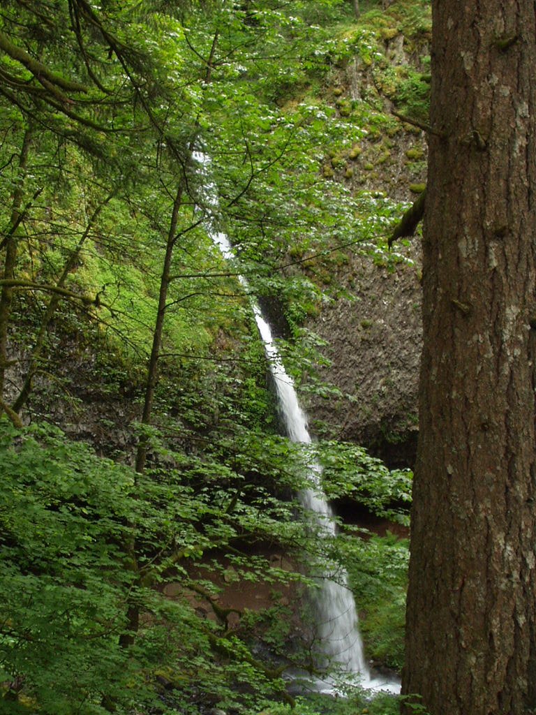
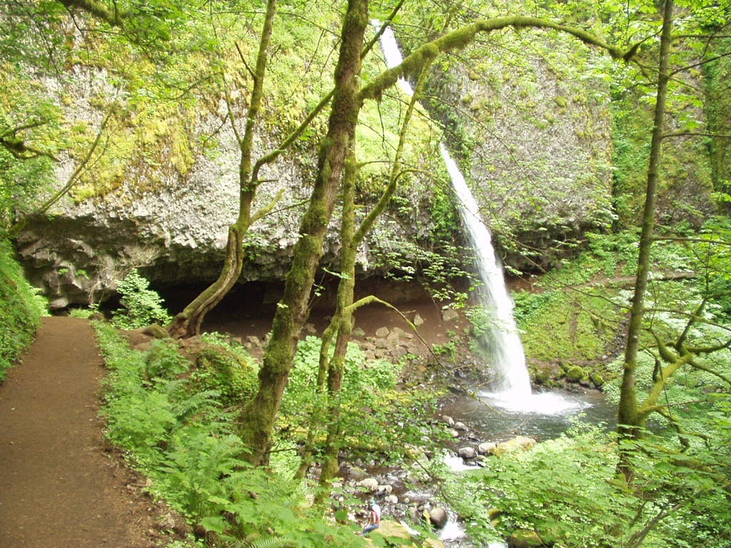
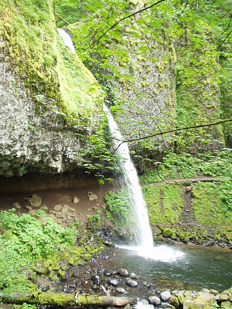
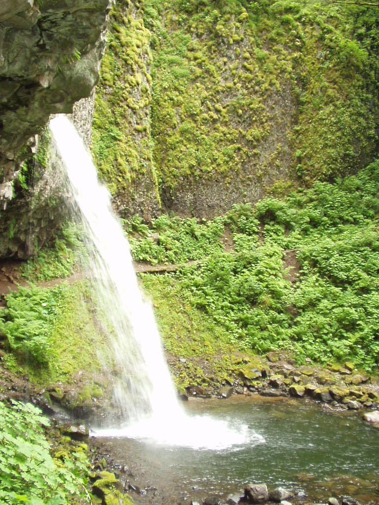

At first glance, one might think that the above shown waterfall is one of those found at Silver Creek Falls. It is, actually, Upper Horsetail Falls (Aka Ponytail Falls) situated high above in the Oneonta Gorge. The roar off this fall is no less quiet than any of its taller rivals back at Silver Creek. On our way back through heading back towards camp, we decided to make a stop here and take a moment to sit under the water fall and freeze the living daylights out of ourselves. We didn't go under the main fall, that was beyond any possible notion of being a good idea. So, we stood under the smaller slower fall off that was behind the bigger spout of water and took turns seeing who could stay in longer before drying off a bit and continuing the hike.
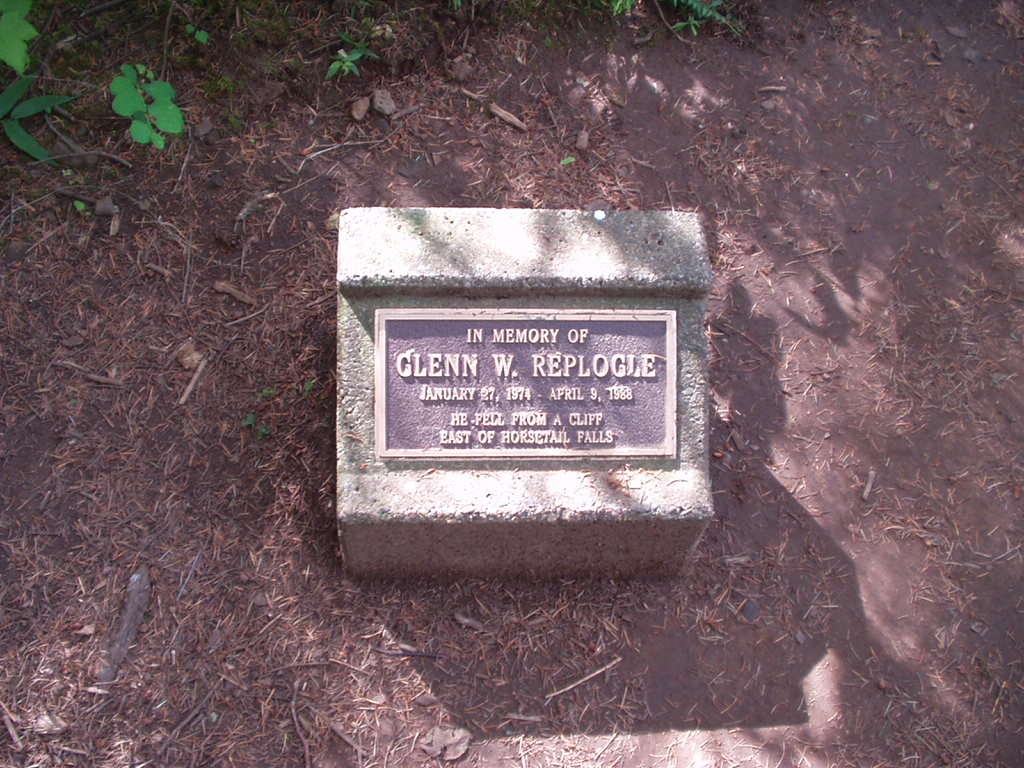
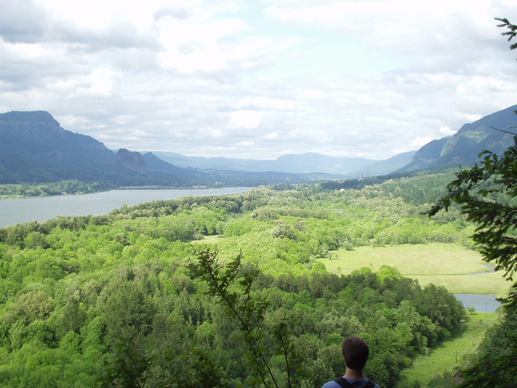
After viewing the beauty of Upper Horsetail (Ponytail) Falls, we continued on our journey, exploring all the knooks and cranies of this dense wooded canopy that I never knew existed. Upon my travelings which brought me to the vantage point from which the second and third photos were shot in the above batch, I came across the marker in the first photo. It was a sad moment to think about a life so young dying in such a horrible way, the spot from which I was shooting those pictures made me think of how easily it would have been to have fallen in the same way, as the spur of rock and dirt only 2 feet wide jutted out into the open empty air above the Columbia River Gorge with the tiny black strip of the asphalt of Highway 36 directly beneath me.
Sufice to say, the misses to be didn't come any closer than 20 yards away and my prancing upon the precipise sent her into many a fit of worried noises. She was greatly relieved when I returned from the brink with a set of photos and all my parts still connected.
My camera had been working spotily since it kissed the ground during the Sol Duc Adventure last year. It seems to rarely take a super crisp picture anymore, and my frustration with it was starting to eat at me. Fortunately, on our way to our second water fall for the trip, we found this wall, where the water sprinkles off the edge making a delightful shower for cooling ones self off in, but without the worry of getting completely soaked.
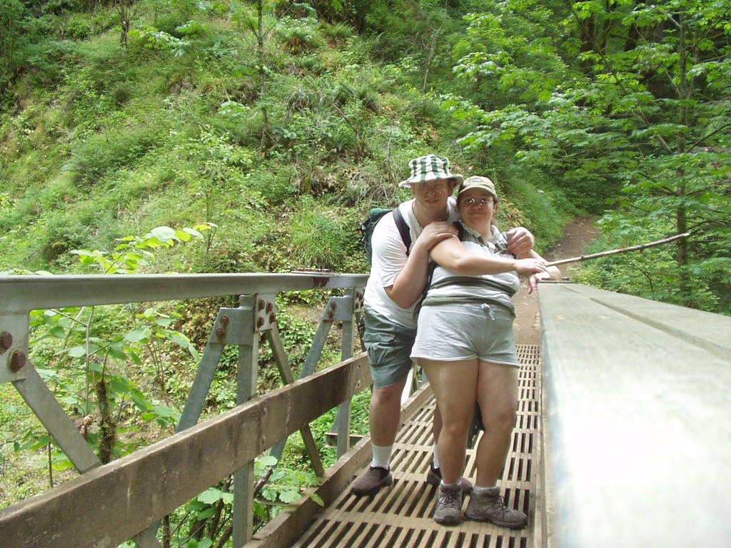
I don't know why we did the close up, other than the fact that since I am usually the camera man most of my trips, it is very very rare that I come back with a picture of me doing anything.
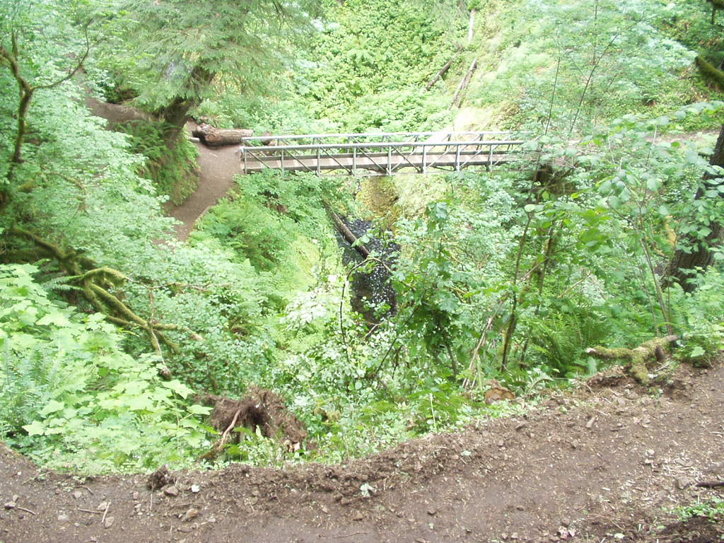
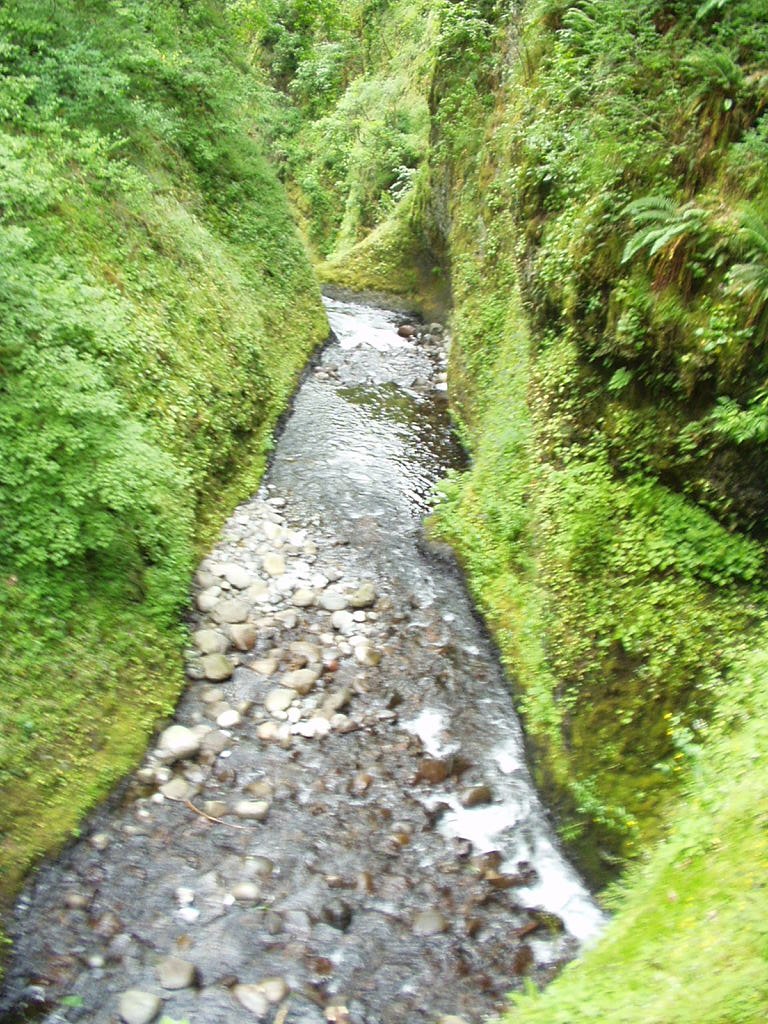
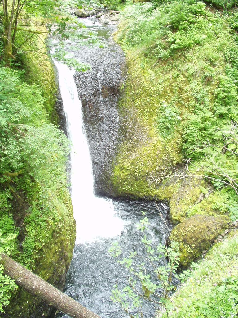
This is Oneonta Falls, its the smaller falls in the Oneonta Gorge, there is one more above them, known as Triple Falls, however, we ran out of daylight and time to really hike much past this point. However, it does give you a good look at how water can cut through rock. The stream runs right through the center of the gorge in what looks like an almost square path. The view coming down the little hill towards that bridge is rather breath taking as you see the Oneonta creek cutting on through the squared off high walls of the gorge.
You can read more about the Oneonta Gorge and its falls here:
Oregon Hikes - Oneonta Gorge
Since we were running out daylight by this point, it was decided that we'd hike down out of the hills via the route down to the lower Horsetail Falls and return via the Highway, the idea of going back across that section of rocks and narrow winding trail was not too appealing by this point.
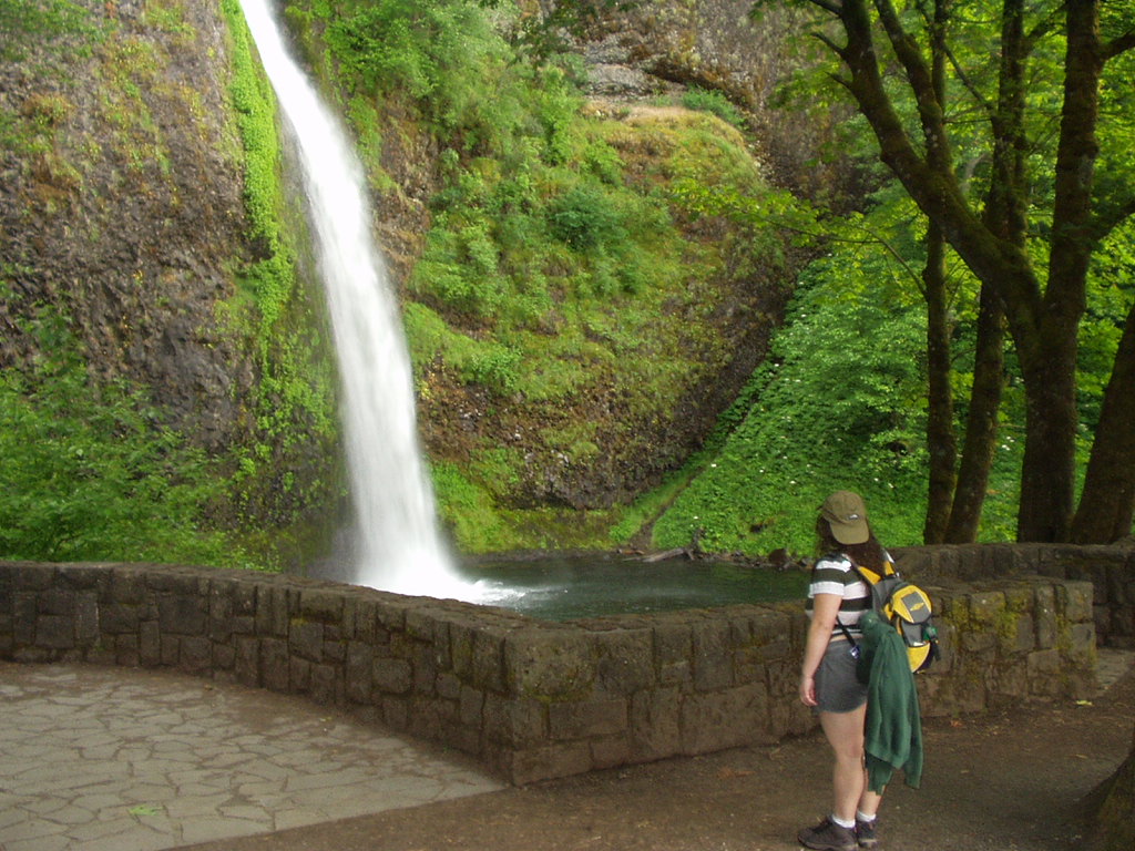
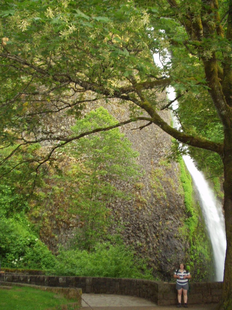
The photo on the left is somewhat decieving to how tall Lower Horsetail Falls is. The second photo, the one on the right, gives the water fall in a better perspective, namely, from across the highway in the parking lot.
After snapping those last couple photos, we hiked back to camp and I fixed us some wonderful barbacue burgers while the lady went off to the main campground showers to wash up. She thought they were great, which only goes to show that the men's side showers must have sucked in comparison, because one time through and the camper's somewhat cramped bathroom was more appealing.
The following day found us stuffed to the gills from a Sausage, Biscuits, Scrambled Eggs, Bacon and French Toast breakfast, and ready to pack up and head out. One thing I love about having the camper over how I used to camp with the pullman, its so much faster and easier to setup and break down camp. Everything we had in camp was either stored in the camper's gear cabinet, or rode in one of the two blue sterlite totes I had strapped to the cargo rack mounted in the hitch extension.
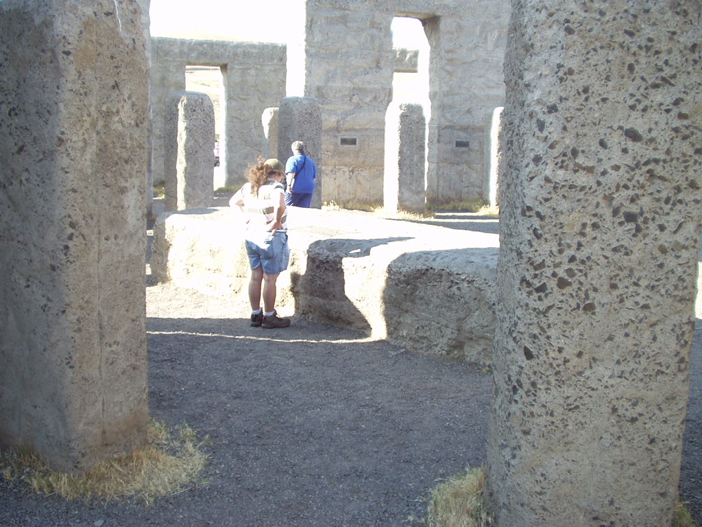
Our destination for this day was Maryhill, WA and the Stonehenge War Memorial.
We set out, and with the windows down (It was hot out, but the breeze felt good, and the lack of the A/C pump running made the truck happier.)
I kept wondering where I was going to see the turn off for the bridge that would cross to Maryhill, I had looked up the route in my Oregon Road Atlas, but only vaguely remembers that it was somewhere just east of the Dalles Dam.
In our search, our breakfast made its course, and a reststop was needed. Just east of the Dalles Dam, we pulled off at a sign for some state park, I forget the name, but its named after the Indian Tribe that used to fish the waterfalls that were once on the Columbia River before the Dalles Dam was built.
When we got to the bottom of the off ramp, I saw another small park to our left that butted up to the river. It had bathrooms and since that's what we were needing, it seemed the best choice.
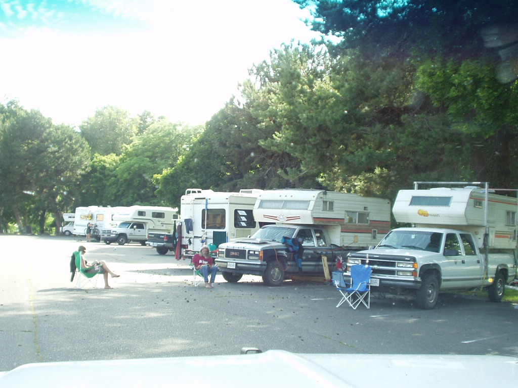
When we pulled in, I noticed that there was quite a number of RVs setup in the parking lot. It took me a second to realize that everyone of them was someone there to windsurf.
The mini camper in the right hand corner of the picture is an Okanagan. The one to its left is another Canadian made unit, but its some odd ass brand that I doubt anyones heard of and I can't remember the name of anyway. I just remember that the company logo is a Maple Leaf.
One thing I also noticed was this park apparently was the local home to disgruntled hippies who have nothing better to do than sit in the middle of the right-of-way in a parking lot and give ugly stares to anyone new. Hence the guy sitting next to the Chevy Pickup with the solar panel on the hood, and the lady that was with him in the green folding chair.
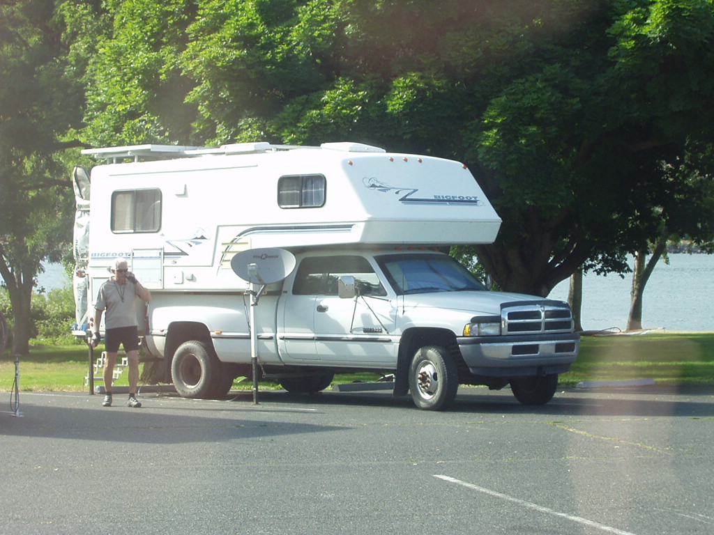
Now, this fella here, has figured out a pretty snazy way of setting up his Satillite dish without it needing a tripod!
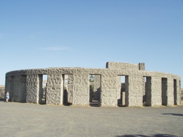
Now, what I figured out while stopped at this park was where the damned bridge and turn off for Maryhill was. To get there from the Oregon side, drive east (If coming from portland) towards the city of Biggs, then take the Hwy 97 Bridge across the Columbia Gorge and go up the hill. Turn right at the top of the hill where the highway merges with another. You'll see a sign for the turn off within short order. As you ascend the hill, the Henge will be on your right.
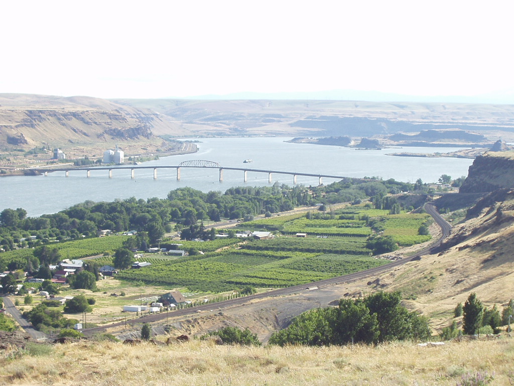
Maryhill is an interesting little farm town community, some some breath taking views of the Columbia Gorge, showing the stark change in the climate and conditions from the areas further west.
To quote the Maryhill Museum website:
Quote:

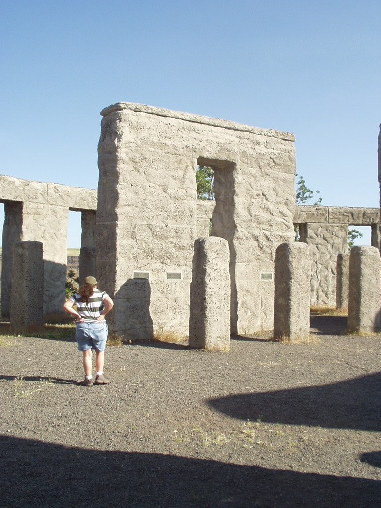
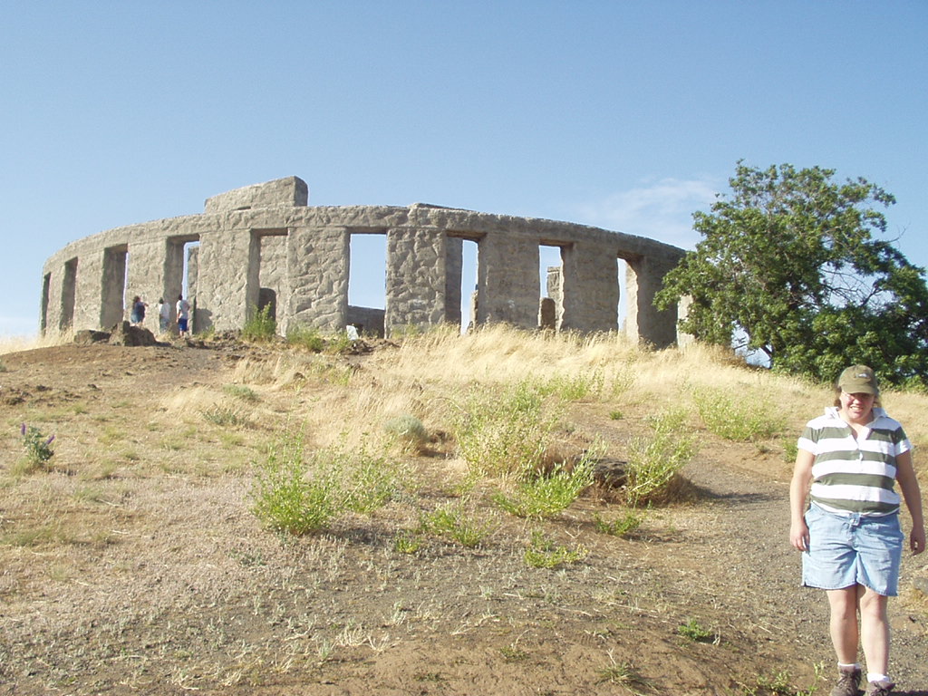
Built by Sam Hill as a tribute to the soldiers of Klickitat County who lost their lives, Maryhill's Stonehenge is the first monument in our nation to honor the dead of World War I. The structure is a full-scale replica of England's famous neolithic Stonehenge. A Quaker pacifist, Hill was mistakenly informed that the original Stonehenge had been used as a sacrificial site, and thus constructed the replica to remind us that ''humanity is still being sacrificed to the god of war.'' The location now also includes monuments to the soldiers of Klickitat County who died in World War II, Korea, and Viet Nam.
The monument lies at the original Maryhill townsite, four miles east of the museum, just off Washington Scenic Route 14. Hill's own crypt is a short walk southwest of Stonehenge on a bluff overlooking the Columbia River.
After touring around Maryhill for a bit, we took the Washington Side of the Columbia Gorge back. Believe me, if you get the chance to ever drive this side of the River, do so! I was unceasingly amazed at how many small lakes had been created when the roadways had been built, plus the sheer number of tunnels.
Our trip came to a close with a nice romantic dinner at the McMennimans Edgefield Resort in Troutdale ending what turned out to a very enjoyable journey.
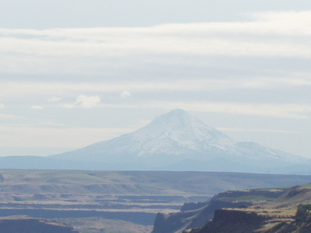
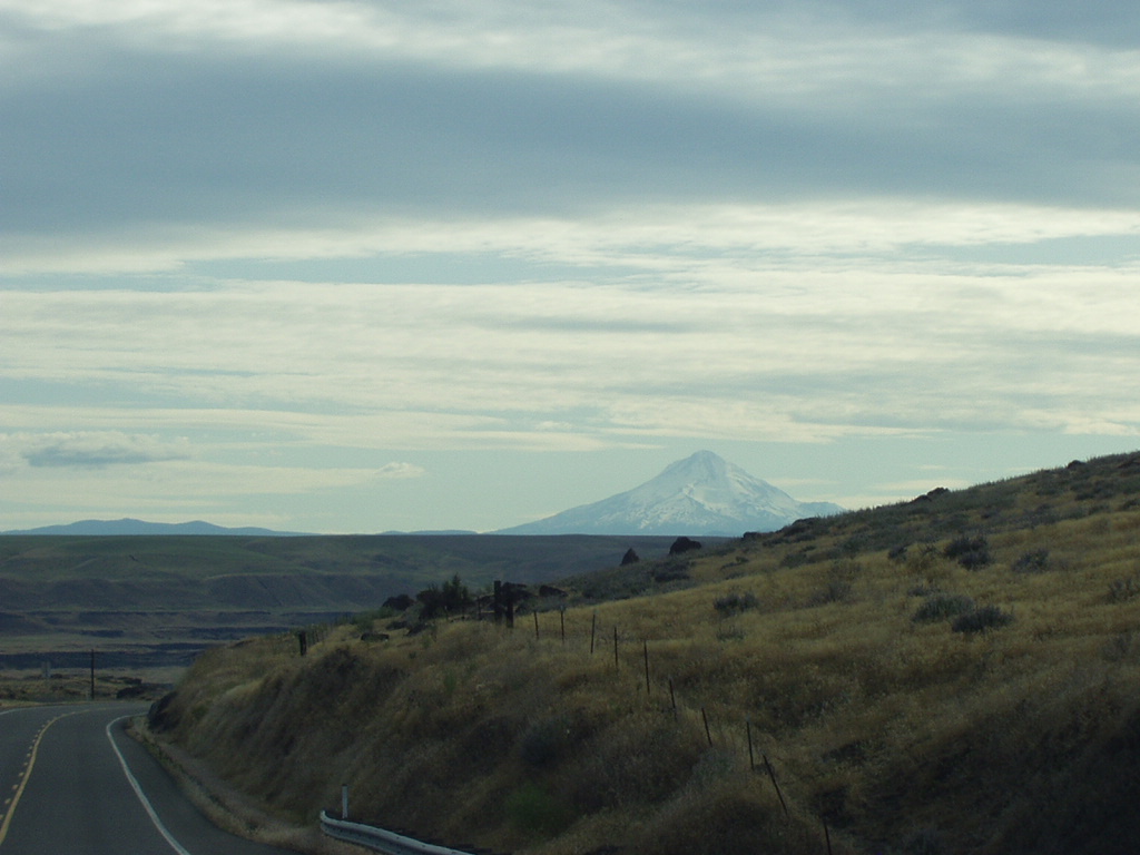
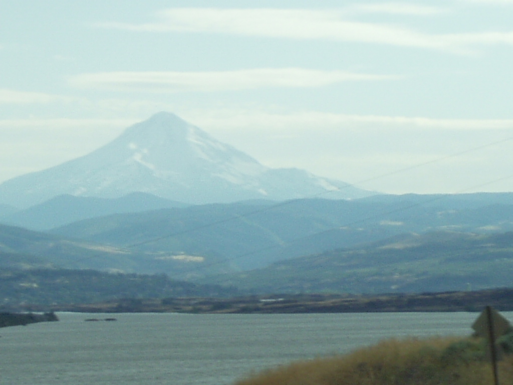
Enjoy my last couple shots of Mt. Hood.
No comments:
Post a Comment